Seaboard & Western Airlines Navigation Chart Overlay
 Aviation Week July 21, 1952
Aviation Week July 21, 1952
Aviation Week July 21, 1952
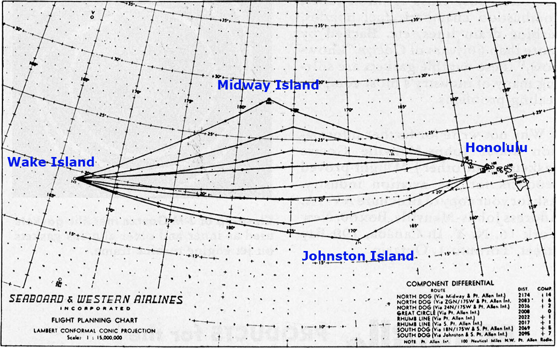
During its participation in the Pacific Airlift for the Korean Conflict, Seaboard developed an advanced form of pressure-pattern flying. A ground navigator studied the weather charts and selected a route that would give the fastest flight time and thereby minimum fuel consumption. During the flight, he would send updated wind information to the flight navigator who used a transparent overlay developed by Seaboard. A separate overlay for each leg showed several possible routes for each leg on either side of the great-circle route that gave the shortest distance. The overlay also listed the distance for each such route and the wind component necessary to compensate for the additional distance. The flight navigator would place the overlay on top of a weather map with the latest wind information and adjust the route to minimize time.
Note: Place names added by webmaster![]()